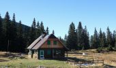
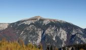
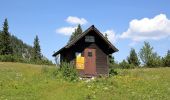
![](/images/other/stat-length.png)
![Randonnée A pied Gemeinde Schwarzau im Gebirge - AT-50 - Photo](https://media.geolcdn.com/t/1900/400/24059739-c40f-4340-8cdc-fa4a0dbdf6f6.jpeg&format=pjpeg&maxdim=2)
AT-50
SityTrail - itinéraires balisés pédestres
Tous les sentiers balisés d’Europe GUIDE+
![Longueur](/images/other/stat-length.png)
Longueur
7,4 km
![Altitude max](https://static1.geolcdn.com/siteimages/upload/files/1508320355ic_sort_altitude_max_24dp.png)
Altitude max
1653 m
![Dénivelé positif](https://static1.geolcdn.com/siteimages/upload/files/1508320355ic_sort_den_pos_24dp.png)
Dénivelé positif
40 m
![Km-Effort](/images/other/stat-length.png)
Km-Effort
11,6 km
![Altitude min](https://static1.geolcdn.com/siteimages/upload/files/1508320355ic_sort_altitude_min_24dp.png)
Altitude min
560 m
![Dénivelé négatif](https://static1.geolcdn.com/siteimages/upload/files/1508320355ic_sort_den_neg_24dp.png)
Dénivelé négatif
1120 m
![Boucle](https://static1.geolcdn.com/siteimages/upload/files/16400158638029165_repeat_loop_refresh_sync_direction_icon.png)
Boucle
Non
Balise
Date de création :
2022-02-16 16:47:59.762
Dernière modification :
2022-03-03 12:10:08.465
![A pied](https://static1.geolcdn.com/sitytour/trail-icons/100.png)
2h37
Difficulté : Facile
![Scannez ce code QR pour ouvrir la randonnée dans l'application SityTrail](https://capi.geolives.com/qq0zvz2zws4bq2lad0pu/sitytour/trails/3127900/qr.png?size=200)
Application GPS de randonnée GRATUITE
À propos
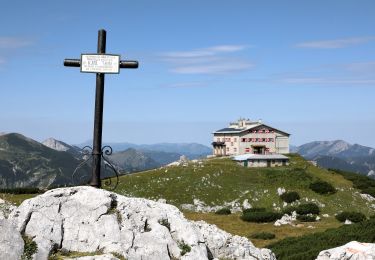
Randonnée A pied de 7,4 km à découvrir à Basse-Autriche, Bezirk Neunkirchen, Gemeinde Schwarzau im Gebirge. Cette randonnée est proposée par SityTrail - itinéraires balisés pédestres.
Description
Randonnée créée par ÖGV.
Localisation
Pays :
Autriche
Région :
Basse-Autriche
Département/Province :
Bezirk Neunkirchen
Commune :
Gemeinde Schwarzau im Gebirge
Localité :
Unknown
Départ:(Dec)
Départ:(UTM)
554895 ; 5285936 (33T) N.
Commentaires
Randonnées à proximité
![Randonnée A pied Gemeinde Neuberg an der Mürz - Wanderweg 824b: Ochsenhaltweg - Photo](https://media.geolcdn.com/t/375/260/9f5f3bea-2df0-4520-8ac2-6c624cee4450.jpeg&format=jpg&maxdim=2)
![A pied A pied](https://static1.geolcdn.com/sitytour/trail-icons/100.png)
Wanderweg 824b: Ochsenhaltweg
A pied
Facile
Gemeinde Neuberg an der Mürz,
Styrie,
Bezirk Bruck-Mürzzuschlag,
Autriche
![](/images/other/stat-length.png)
3,4 km | 6,3 km-effort
1h 25min
![](https://static1.geolcdn.com/siteimages/upload/files/16400158638029165_repeat_loop_refresh_sync_direction_icon.png)
Non
![Randonnée A pied Gemeinde Schwarzau im Gebirge - Schüttersteig - Photo](https://media.geolcdn.com/t/375/260/a716fd13-1ea0-4f7f-9010-4c0d59118b6c.jpeg&format=jpg&maxdim=2)
![A pied A pied](https://static1.geolcdn.com/sitytour/trail-icons/100.png)
Schüttersteig
A pied
Facile
Gemeinde Schwarzau im Gebirge,
Basse-Autriche,
Bezirk Neunkirchen,
Autriche
![](/images/other/stat-length.png)
6,5 km | 15,9 km-effort
3h 36min
![](https://static1.geolcdn.com/siteimages/upload/files/16400158638029165_repeat_loop_refresh_sync_direction_icon.png)
Non
![Randonnée A pied Gemeinde Reichenau an der Rax - Miesleitensteig - Photo](https://media.geolcdn.com/t/375/260/94a78a72-401f-4035-8f29-45b74e3c167e.jpeg&format=jpg&maxdim=2)
![A pied A pied](https://static1.geolcdn.com/sitytour/trail-icons/100.png)
Miesleitensteig
A pied
Facile
Gemeinde Reichenau an der Rax,
Basse-Autriche,
Bezirk Neunkirchen,
Autriche
![](/images/other/stat-length.png)
4,6 km | 12 km-effort
2h 43min
![](https://static1.geolcdn.com/siteimages/upload/files/16400158638029165_repeat_loop_refresh_sync_direction_icon.png)
Non
![Randonnée A pied Gemeinde Neuberg an der Mürz - Schutzsteig - Photo](https://media.geolcdn.com/t/375/260/5836395b-5cbc-4721-abf5-8cb43e2d7a1d.jpeg&format=jpg&maxdim=2)
![A pied A pied](https://static1.geolcdn.com/sitytour/trail-icons/100.png)
Schutzsteig
A pied
Facile
Gemeinde Neuberg an der Mürz,
Styrie,
Bezirk Bruck-Mürzzuschlag,
Autriche
![](/images/other/stat-length.png)
5 km | 8 km-effort
1h 49min
![](https://static1.geolcdn.com/siteimages/upload/files/16400158638029165_repeat_loop_refresh_sync_direction_icon.png)
Non
![Randonnée A pied Gemeinde Reichenau an der Rax - Brandschneide - Photo](https://media.geolcdn.com/t/375/260/be8b0966-df41-423a-936d-9c7fa004abb9.jpeg&format=jpg&maxdim=2)
![A pied A pied](https://static1.geolcdn.com/sitytour/trail-icons/100.png)
Brandschneide
A pied
Facile
Gemeinde Reichenau an der Rax,
Basse-Autriche,
Bezirk Neunkirchen,
Autriche
![](/images/other/stat-length.png)
3,5 km | 13,2 km-effort
2h 59min
![](https://static1.geolcdn.com/siteimages/upload/files/16400158638029165_repeat_loop_refresh_sync_direction_icon.png)
Non
![Randonnée A pied Gemeinde Reichenau an der Rax - Ottohaus - Neue Seehütte - Predigtstuhl - Karl-Ludwig-Haus - Photo](https://media.geolcdn.com/t/375/260/aa8eeb88-9dd4-4904-a15a-7a7bbc51b54e.jpeg&format=jpg&maxdim=2)
![A pied A pied](https://static1.geolcdn.com/sitytour/trail-icons/100.png)
Ottohaus - Neue Seehütte - Predigtstuhl - Karl-Ludwig-Haus
A pied
Facile
Gemeinde Reichenau an der Rax,
Basse-Autriche,
Bezirk Neunkirchen,
Autriche
![](/images/other/stat-length.png)
6,2 km | 10,5 km-effort
2h 23min
![](https://static1.geolcdn.com/siteimages/upload/files/16400158638029165_repeat_loop_refresh_sync_direction_icon.png)
Non
![Randonnée A pied Gemeinde Reichenau an der Rax - Gaislochboden - Dirnbacherhütte - Seehütte - Photo](https://media.geolcdn.com/t/375/260/726b16de-5cc0-45c6-b1ef-046b03313ba1.jpeg&format=jpg&maxdim=2)
![A pied A pied](https://static1.geolcdn.com/sitytour/trail-icons/100.png)
Gaislochboden - Dirnbacherhütte - Seehütte
A pied
Facile
Gemeinde Reichenau an der Rax,
Basse-Autriche,
Bezirk Neunkirchen,
Autriche
![](/images/other/stat-length.png)
4,2 km | 8 km-effort
1h 48min
![](https://static1.geolcdn.com/siteimages/upload/files/16400158638029165_repeat_loop_refresh_sync_direction_icon.png)
Non
![Randonnée A pied Gemeinde Reichenau an der Rax - Dörfl - Griesleiten - Photo](https://media.geolcdn.com/t/375/260/ee0b1f3f-b16c-4b9c-ad88-83470529c5de.jpeg&format=jpg&maxdim=2)
![A pied A pied](https://static1.geolcdn.com/sitytour/trail-icons/100.png)
Dörfl - Griesleiten
A pied
Facile
Gemeinde Reichenau an der Rax,
Basse-Autriche,
Bezirk Neunkirchen,
Autriche
![](/images/other/stat-length.png)
5,3 km | 9,4 km-effort
2h 8min
![](https://static1.geolcdn.com/siteimages/upload/files/16400158638029165_repeat_loop_refresh_sync_direction_icon.png)
Non
![Randonnée A pied Gemeinde Neuberg an der Mürz - Prein (Jugendheim) - Oberer Eggl-Waxriegelhaus - Photo](https://media.geolcdn.com/t/375/260/add352eb-db94-4ac2-a56b-760f47bdc2fa.jpeg&format=jpg&maxdim=2)
![A pied A pied](https://static1.geolcdn.com/sitytour/trail-icons/100.png)
Prein (Jugendheim) - Oberer Eggl-Waxriegelhaus
A pied
Facile
Gemeinde Neuberg an der Mürz,
Styrie,
Bezirk Bruck-Mürzzuschlag,
Autriche
![](/images/other/stat-length.png)
3,2 km | 5,2 km-effort
1h 11min
![](https://static1.geolcdn.com/siteimages/upload/files/16400158638029165_repeat_loop_refresh_sync_direction_icon.png)
Non